Aug. 17, 2023
Contact: Eric Stann, 573-882-3346, StannE@missouri.edu
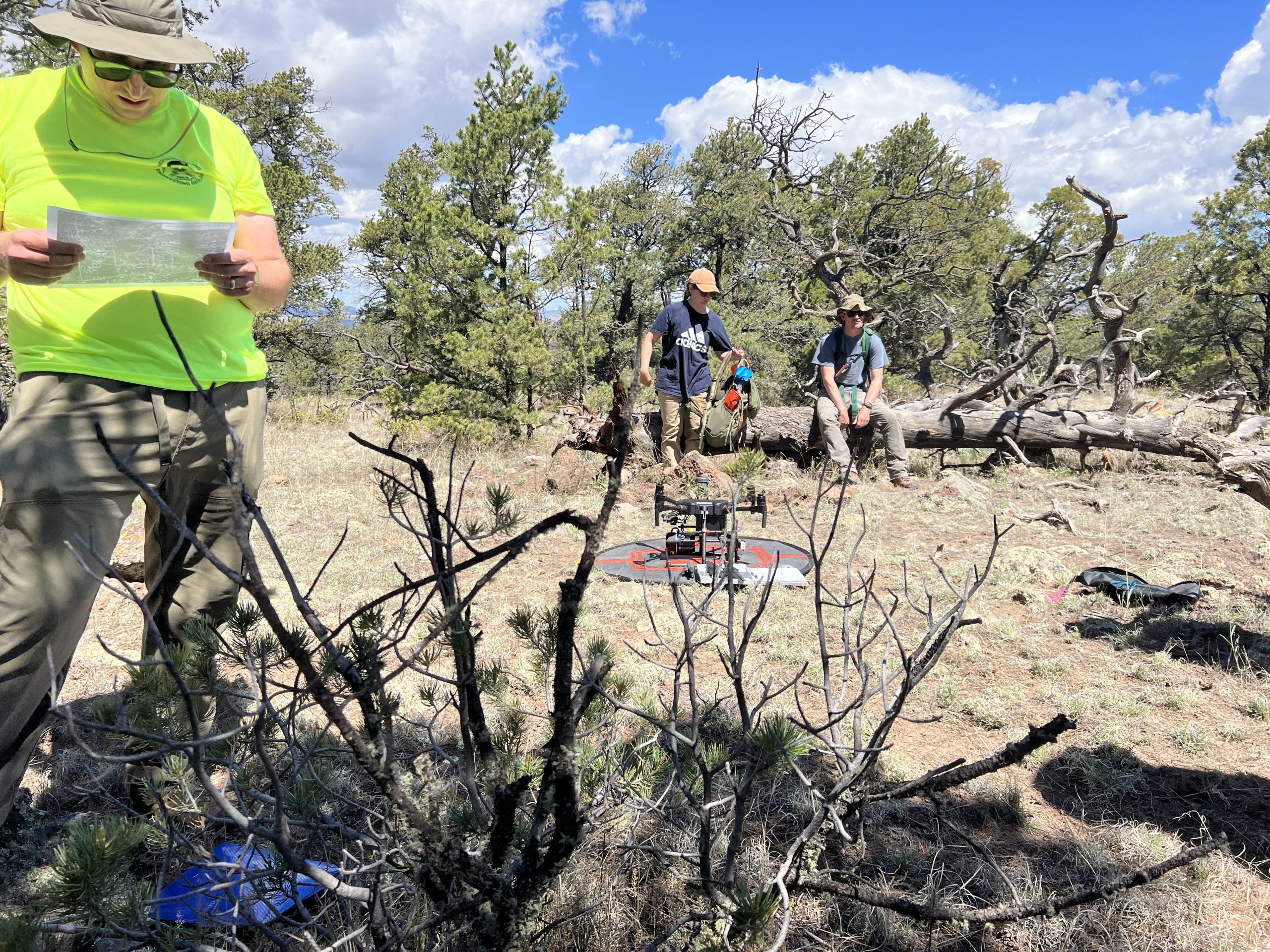
Jeff Ferguson, Rob Walker and Francisco “Paco” Gomez at the University of Missouri are part of an interdisciplinary research team using drones equipped with light detection and ranging, or lidar, to study ancient Native American villages called pueblos in the Lion Mountain area of western New Mexico. The team’s goal is to better understand the connection between migration and social interaction patterns and pueblo occupations.
“Among the archaeological sites discovered in the area is a massive pueblo likely built and occupied by immigrants from the large-scale abandonment of the Four Corners region, including Mesa Verde, in the late 13th century,” said Ferguson, an associate professor in the Department of Anthropology. “Our research is focused on documenting the regional settlement pattern and understanding how the migrants coming from the north interacted with existing local populations. Using this technology, we aim to efficiently identify any sites not previously documented.”
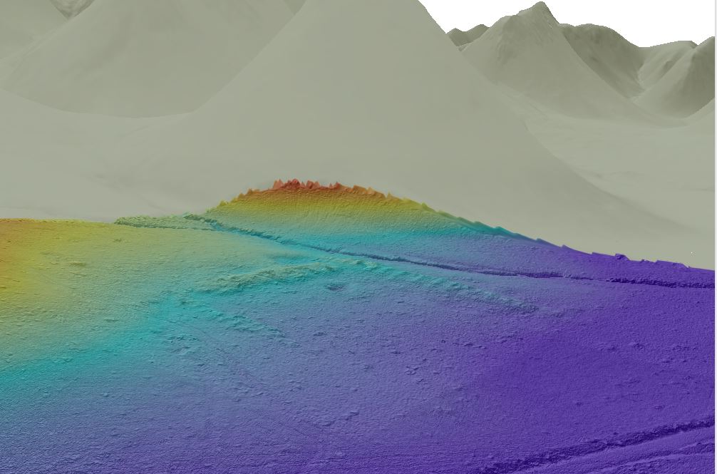
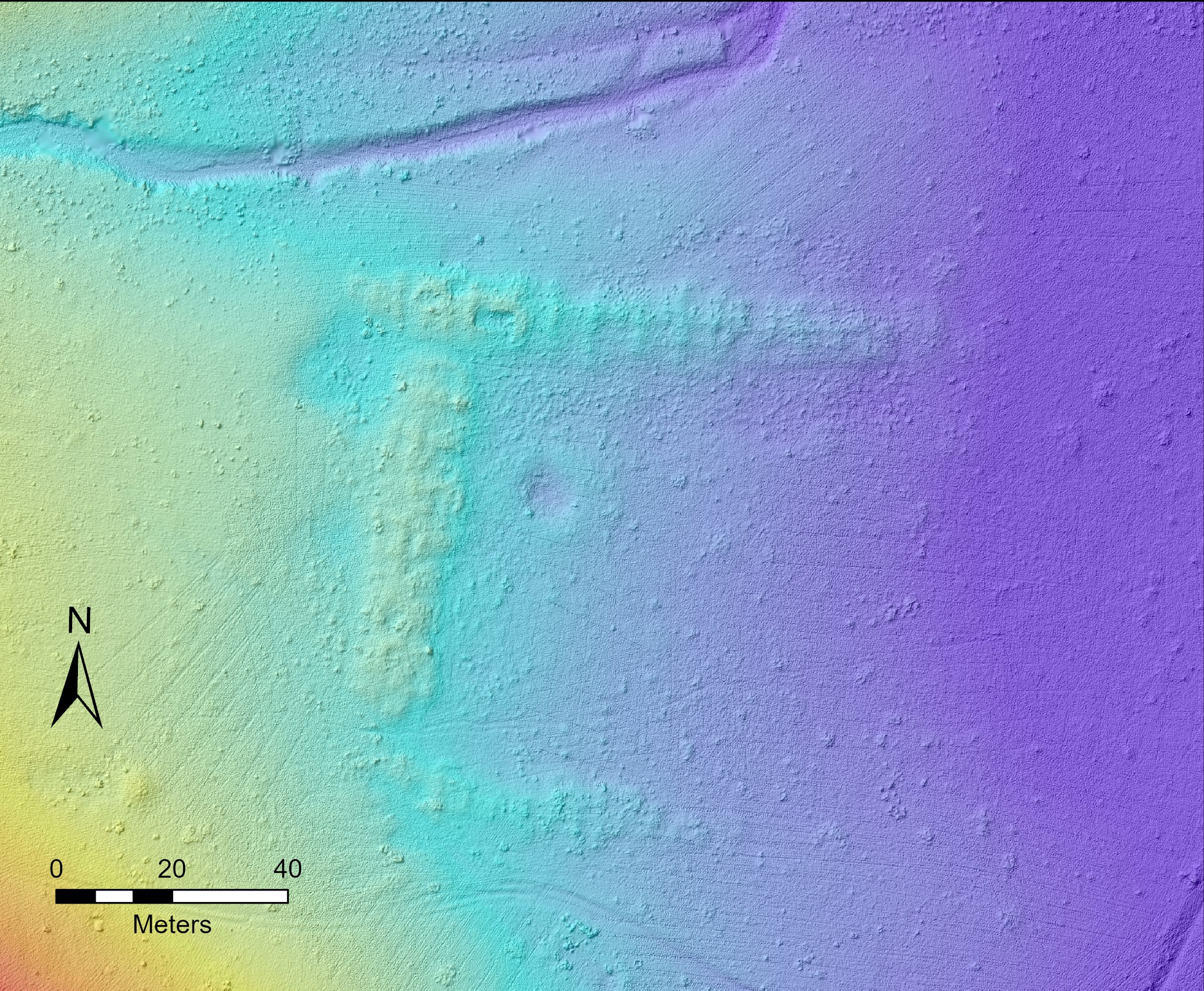
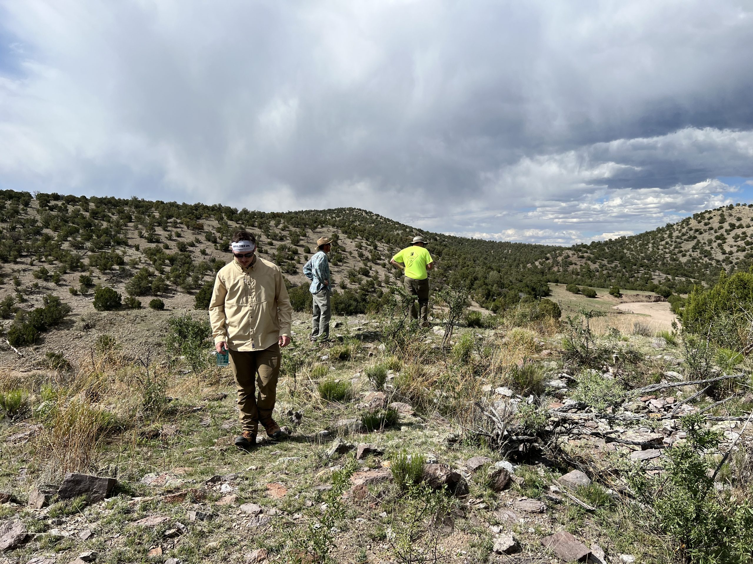
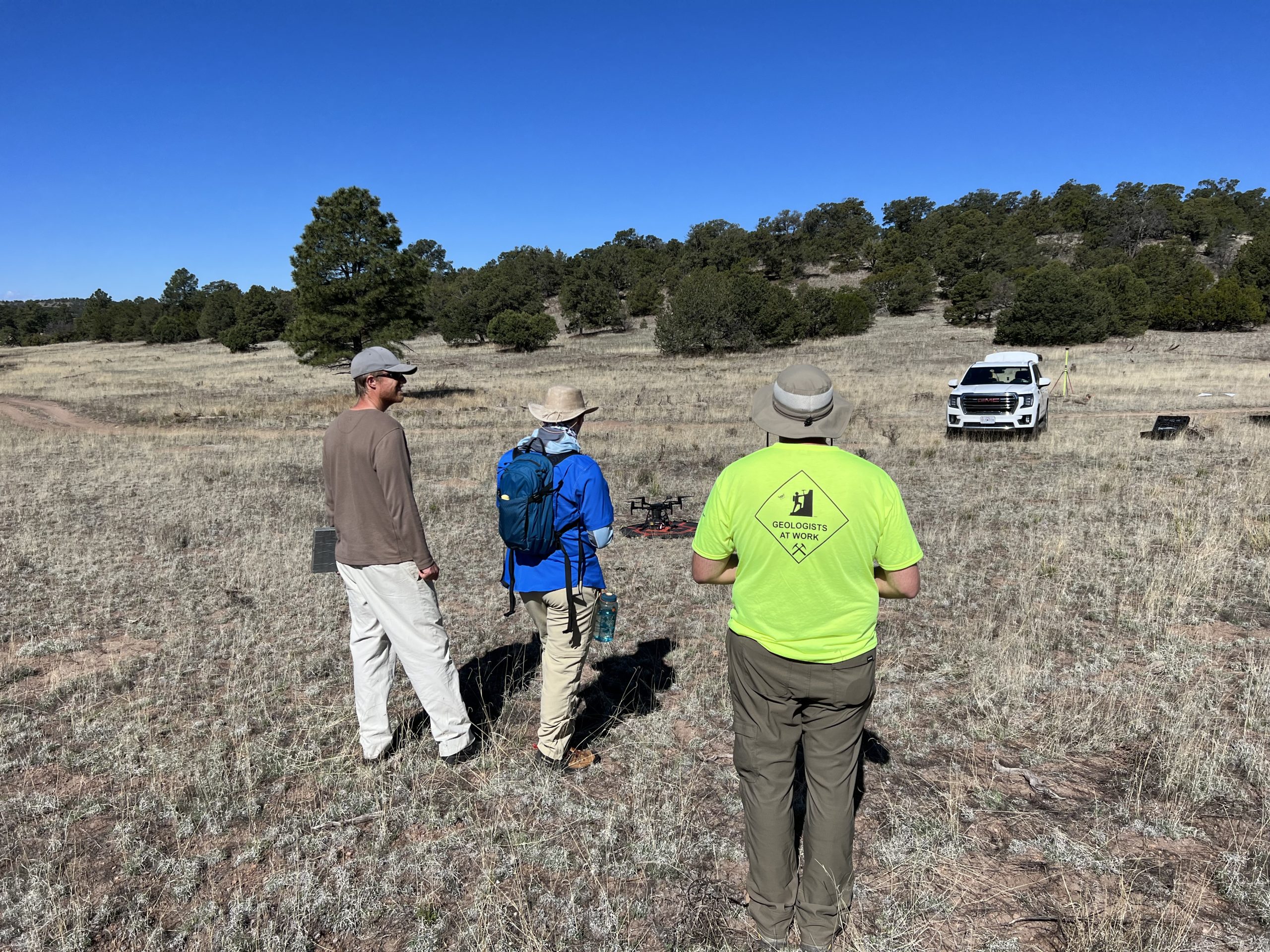
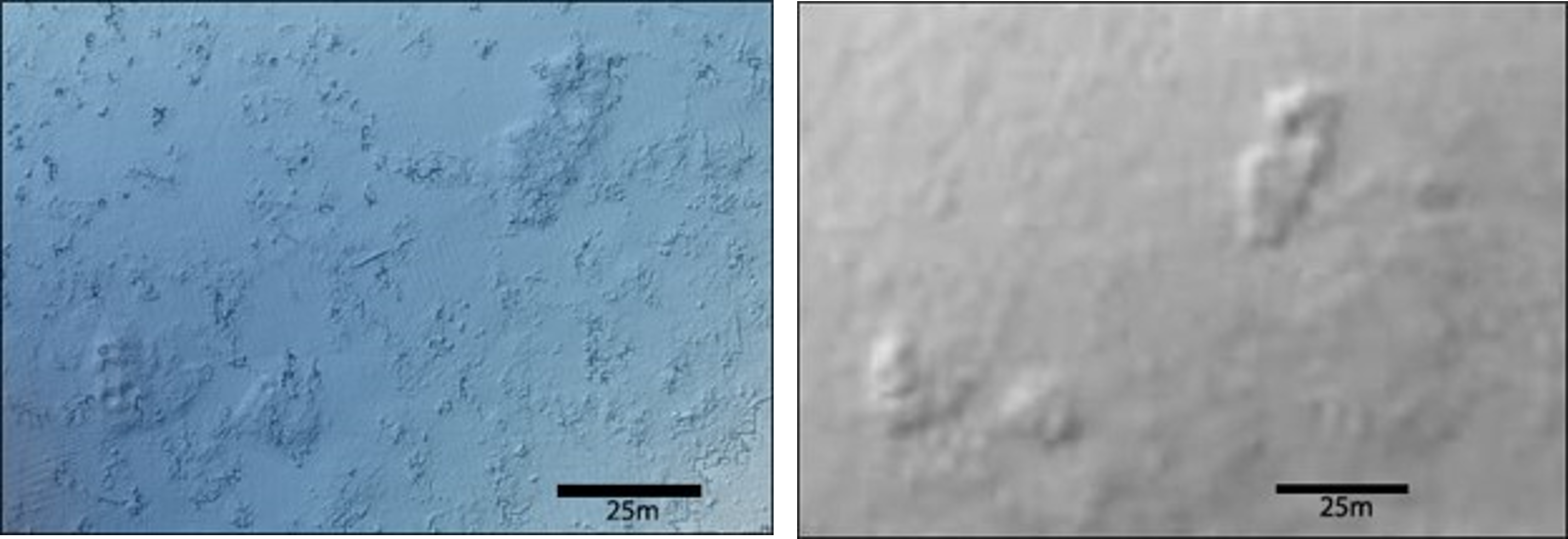
Lidar is a technique that uses laser pulses to “map” the ground surface. While drone-based lidar can provide more detailed images of the ground surface than plane-based lidar, the team is exploring whether drones can be used efficiently to conduct the large-scale land surveys needed to search for these sites — efforts that can sometimes encompass hundreds of square miles. After the sites are identified by air, they must be verified by researchers doing field work on the ground through a process known as “ground-truthing.”
“It’s not always obvious that these features are architectural in nature,” Ferguson said. “It could be difficult to distinguish between a natural rock outcrop or a cultural feature, so we must look at factors like alignment, positioning, size, type of rock and whether other cultural artifacts are present.”
Sensitive to the cultural significance of these sites, the researchers are partnering with a cultural resource advisory team from the Pueblo of Zuni, one of several Native American groups who claim these ancestral sites as part of their cultural heritage. Ferguson described one such meeting last year after researchers discovered a small set of vertical stones placed in a box shape in the ground. The Zuni Cultural Resource Advisory Team (ZCRAT) determined it was a shrine and identified numerous others at additional sites. Researchers are planning additional fieldwork in partnership with ZCRAT in fall 2023.
Asking more in-depth questions
The use of drones to search for these sites has already opened the door for researchers to ask more in-depth questions about the migration patterns.
“We can look at a single migrant community and try to understand how that community integrated with local groups,” Ferguson said. “We’re using this information to ask questions like ‘how are all these people interacting?’ or ‘what’s the interaction between this likely migrant community and these local populations?’”
Obsidian sourcing
Another way for researchers to better understand how ancient Native Americans in the Lion Mountain area interacted within a broader social and economic network is by analyzing their use of obsidian, a stone used to make sharp tools for cutting and hunting.
“The chemical composition of the obsidian artifacts can be compared to known natural outcrops and help determine the geologic source of the artifacts,” said Ferguson, who also teaches college students how to replicate stone tools. “The use of obsidian sourcing can be a good indicator of social and economic interaction in the past.”
In a recently published study in the Journal of Field Archeology, Ferguson and colleagues detailed the use of a portable, handheld instrument called energy dispersive X-ray fluorescence spectrometry (ED-XRF), which allows them to analyze pieces of obsidian while in the field, eliminating the need for collecting these items for analysis in the laboratory.
“As we are ground-truthing, we identify all the obsidian in one area, then we pick each one up and run them in the instrument,” Ferguson said. “Using this method, we can collect thousands of data points without having to actually collect any artifacts.”
Involving artificial intelligence
Researchers like Ferguson and Walker, an associate professor in Department of Anthropology, are working to find a way to incorporate artificial intelligence and machine learning into this process.
“The ultimate goal is to figure out how we can train machines to find these features even better and more efficiently than humans looking at the data,” Ferguson said. “Once we know which areas have features or sites, we can train the model to say, ‘this site is over here, now go and see what you can find through ground-truthing.’”
In addition to using the above applications to explore large-scale trade, researchers are developing plans to incorporate compositional analysis of pottery to better understand more local interactions between the area’s individual communities. This research would involve analysis at the MU Archaeometry Laboratory at the MU Research Reactor (MURR).
Editor's note
Sean Polun, a post-doctoral fellow in the Department of Geological Sciences, was also involved in the project.